FREE MAPS INCLUDED
● OpenStreetMap© & OpenCycleMap Global street & terrain mapping
● Bing Aerial Imagery, Ski map, Transport map.
Use in-app purchasing (ViewRanger Store) to add official USGS/Accuterra topographic mapping for the whole of the USA. NR CAN maps are available for Canada as well as many other premium topographic maps for other countries.
-------------------------------
FEATURES INCLUDED
● GPS mapped location, even without mobile signal
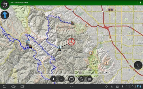
● Offline map mode* – store in advance using “Create Saved Map”
● Access to 1000's of route guides
● Track recording – view your path on map to keep or share, even add Flickr photos
● Sports computer stats – view distance, speed, etc
● Real time location sharing** – BuddyBeacon (requires data connection)
● Active Route Navigation***
● Synchronises with web account for route planning, publishing and sharing. (http://my.viewranger.com)
● Integrated with Facebook, Twitter
-------------------------------
Already a fan of ViewRanger? Like us on Facebook or Follow us on Twitter for the latest news and updates:
https://www.facebook.com/viewranger
https://www.twitter.com/viewranger
-------------------------------
A choice of Global open-source maps are included for free and are streamed over data connection, that can be cached for offline use. With ViewRanger, you can choose the best map to use and you'll always know your mapped location, even where there’s no mobile signal.
It’s easy to record a track of your progress, so you can view your path and stats for every trip. Your tracks can be stored using your free web account (my.viewranger.com) or shared using Facebook or Twitter, you can even add photos using Flickr. You can also use BuddyBeacon, our PIN protected real-time** tracker & location sharing feature.
Planning a trip? Use ViewRanger to create & follow your own routes or simply download one from our growing library of expert and community generated walks and cycle rides***. And as our expert guided routes are created by book publishers, forest service and outdoors magazines they are packed with local knowledge to enhance your experience.
ViewRanger is designed for Hiking, Backpacking, Mountain Biking, Cycling, Skiing, Snowboarding, snowmobiling, Horse riding, cross country running, ATV and Quad biking, , Hot air ballooning, Micro-light flying, Nature watching, Photography and most outdoors activities. It’s used & trusted by most Search & Rescue teams.
-------------------------------
What our customers have to say:
“Simply the best off-road walking and cycling app anywhere."
“Not only is this an excellent app, but the helpfulness and speed of their response to my queries was exceptional."
-------------------------------
Paid for Map choice available in over 22 countries:
Great Britain Ordnance Survey, Ireland (OS Ireland and OS NI), Germany (BKG), France (IGN), USA (USGS/Accuterra), Austria and Liechtenstein (Kompass), Belgium (IGN/NGI) Canada (NR Can), Czech Republic (DPA), Finland (NLS), Netherlands (Kadaster), New Zealand (LINZ), Norway (Statkart), Slovenia (NMA) Spain (CNIG), The Canaries Islands (Discovery Walking), Sweden (Lantmäteriet)), Switzerland (Swisstopo), Denmark (Geodatastyrelsen), Madeira, Greece (TERRAIN Editions SA), Slovakia, (DPA), and parts of Italy.
*store in advance using “Create Saved Map”. ** requires mobile signal. *** may incur additional charges
Free Global maps © 2012 OpenStreetMap, CC-BY-SA & contributors.
Need more info? visit: http://www.viewranger.com. Any questions or feedback, please drop us an e-mail: [email protected]
We do not host ViewRanger Outdoors GPS USA on our servers. We did not scan it for viruses, adware, spyware or other type of malware. This app is hosted by Google and passed their terms and conditions to be listed there. We recommend caution when installing it.
The Google Play link for ViewRanger Outdoors GPS USA is provided to you by apps112.com without any warranties, representations or guarantees of any kind, so access it at your own risk.
If you have questions regarding this particular app contact the publisher directly. For questions about the functionalities of apps112.com contact us.

|
| ||||
| Downloads: 28 | ||||
| Updated At: 2024-04-22 18:51:38 | ||||
| Publisher: Augmentra | ||||
| Operating System: Android Varies With Device | ||||
| License Type: Free Trial |